
Neshaminy Creek Greenway
The Neshaminy Creek Trail, also known as Neshaminy Greenway Trail, is a planned trail and is part of the Circuit Trails network, a system of multi-use trails in the Greater Philadelphia and southern New Jersey region that, when finished, will include more than 850 miles of trails.
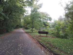
Once complete, it will span 39 miles from Peace Valley Park near Chalfont to Neshaminy State Park, and connect to the East Coast Greenway in Bensalem. Currently, two segments are open, the paved trail begins at Upper State Road in New Britain Borough and heads southeast, paralleling a wooded creek, to connect to the 202 Parkway Trail.
State: Pennsylvania
Location: Bucks County
Trail Length: 4.83 miles open. When complete, the trail will be 39 miles.
Surface: Asphalt
Status: In progress
Getting to the Trail
Parking and Public Transportation Options
Parking is available at 1606 Upper State Rd, Doylestown, PA 1890, 1645 Upper State Rd, Doylestown, PA 18901, and at Central Park, 425 Wells Rd, Doylestown, PA 18901.
If you are taking public transportation, the trail can be accessed from SEPTA’s Regional Rail Lansdale/Doylestown Line.
Explore the Trail
Trail Activities
Events and activities are happening on Circuit Trails around the region all the time.View all upcoming events #OnTheCircuit here.
Email [email protected] with questions or updates to this trail.
Find more trail information and detailed trail maps on TrailLink.com.
Plan your trip on Traillink.com